
Map of Ireland - Eire
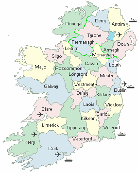
Ireland - The 26 counties of Ireland constitute the Irish Republic, Eire. The Northern part of the country, comprising the 6 counties of Armagh, Derry, Down, Tyrone, Fermanagh & Antrim is under U.K. jurisdiction, since the country was partitioned in the 1920's.

Irish Ancestral Maps & Gifts